|
|

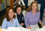

Women's Success Stories
|
MICHELLE BOIVIN The first step to success is stepping out of your comfort zone. At first I was a little timid or scared of speaking out and sharing ideas, but once I finally did, it built my confidence. I think a lot of women go through this, but youve got to make that first step, and the first step is the scariest. |
Career Quick Look
| Salary: | $36K - $100K + | Education: |
| Years in Field: | 10 years | B.A. Degree, Cal State Universtiy Long Beach |
| City/State: | Chula Vista, CA |
Getting Started: In high school, Michelle Boivin was drawn toward more technical subjects, and she was especially interested in math and science. When she graduated, she enrolled at Cal State University, Long Beach, initially studying business, then later switching her major to computer science. She had taken a few geography courses as part of her basic requirements, and one day one of her teachers told her about a new field, GIS, which seemed to touch on several of Michelles interests: regional geography, creativity, math, science, and computers. She took an introductory course in GIS and I absolutely fell in love with it the first time I laid my hands on it, says Michelle. She then switched to her third and final major, geography. Through her college program, she got an internship at the City of Huntington Beach, which later turned into a full-time job. When you first start out, you do a lot of data manipulation; youre scrubbing data, performing quality control, youre really cleaning it up so it gives you the best possible geographic representation. She also produced maps, collected data about municipal features such as parcels, fire hydrants, learned ESRI software (the standard software tool used in GIS), and got exposed to basic business practices.
She then moved on to an analyst position with the city of Charlotte, North Carolina Department of Transportation. In this job, she aided transportation modelers to determine where to build future roads, bike lanes, and sidewalks. There was a fine balance to maintain between demographic growth and existing elements such as landscaping and land use, along with Charlottes pedestrian and bike friendliness initiatives. She also had her first experience in Charlotte of working on an enterprise initiative, which attempted to bring data and projects from multiple municipal departments together. In this role, she learned the basics of project management and business processes. While she was there, she was able to apply and build upon a multitude of skills such as analysis, programming, and cartography, to help manage citizen requests.
The GIS manager for the city of Charlotte became a wonderful role model and mentor. She took Michelle under her wing, encouraged her to volunteer for special projects, helped her break out of her shell, and taught her the business side of GIS. They have since become friends. Michelle next moved back west and worked with the Orange County Fire Authority, where she provided support for two regional fire mapping projects. These projects brought together multiple fire departments to develop common maps, symbology, and labeling so departments with mutual aid agreements would all be working from the same information. From there, Michelle moved to private industry. She has worked for the past year as a consultant for Technology Associates International Corporation (TAIC). She supports a U.S. Marine Corps regional geospatial data center which provides GIS services for the ten western Marine Corps installations. Her role in the GEOFidelis West program involves a wide range of GIS support activities, including troubleshooting via the help desk, maintaining the help desk website, training personnel on ESRI software, providing technical leadership for special projects, and offering specialized support for two of the installations.
Education: Michelle attended Cal State University, Long Beach, where she was awarded a B.A. degree in geography. She found the school environment and her teachers and fellow students quite supportive. The internships offered by her program prepared her well for the technical aspects of her career, but less so for business issues such as budget and project management. Dealing with more mature, experienced co-workers was also a challenge. She has since learned these skills on the job.
To maintain her technical proficiency, Michelle also takes online courses offered by ESRI which add to her basic understanding. She also studied to become an authorized instructor for ESRI, and received certification as a Certified GIS Professional (GISP) based on her experience, education, volunteer work, and published articles. She has taught herself the value of getting out there to gain knowledge and experience. I have kind of a go-getter mentality, she says.
Greatest Professional Achievement: My biggest accomplishment is probably the fact that I feel satisfied in my career. It is very fulfilling, says Michelle. The job in itself is rewarding because I am helping to better our surroundings; whether it is through infrastructure support, environmental management, safety, or educating people. She loves learning new things through volunteering for special projects, and she really enjoys teaching people to use ESRI software as well. If they can go back to their office and use the software, thats a real accomplishment for me. Michelle also reports that the time she spent volunteering with the GIS Corps after Katrina was very rewarding, and led to new career opportunities and an interview with the New York Times.
Barriers: When Michelle entered the work world, she found it difficult at times to work with people who were very set in their ways and didnt want to listen to new ideas. Its a male-dominated profession, says Michelle. You have to earn their respect. Its not given to you. You have to prove yourself.
Michelle overcame these obstacles by responding to requests on the job to volunteer for special projects, which helped her come out of her shell and learn about things she wouldnt otherwise see on a daily basis. For example, her work on a GIS enterprise team in Charlotte taught her about the work of many other departments, including the emergency operations team. She was later able to apply that knowledge to her work with the Orange County Fire Authority and to her current projects at Camp Pendleton.
Working with Men: In Michelles current office, there are about 20 men and six women. Dont back down, we all have good ideas, Michelle advises. Dont back down because you might feel a little timid or scared. I was like that at first, but once I finally put my foot down and broke out of my shell, which I think a lot of women need to do, it built my confidence. But youve got to make that first step, and the first step is the scariest. Michelle reports her first step was presenting a paper in front of 70 people. I dont like public speaking, I can do it now, but I did not like it at all. Giving this presentation helped her feel more comfortable around people, and she continued to build her confidence from there.
Advice for Women: Michelle advises women who are considering a career in GIS, Dont hold back, go into it full force with your heart and your mind. Dont be afraid. There are going to be hard days and there are going to be easy days, but it pays off. It can be difficult at times, but as long as you continue to persevere, success will follow. She also suggests that because of all the different types of roles in GIS, its easy to move to another area if one is not a fit. If you find that you dont like your role in GIS, that doesnt mean you have to give up on it. Theres potential everywhere in the field, for anyone.
Typical Workday/Environment: As a consultant, Michelle currently works on a long-term contract at Camp Pendleton along with several other consultants from TAIC who offer on-site support for the Marine Corps GEOFidelis West program. GEOFidelis West centralizes GIS applications, geospatial data, and support for ten Marine Corps installations in the western U.S.
Michelle has several roles at Camp Pendleton. She supports a help desk, responding to problems with the software or methodology used in GIS, and also maintains the help desk website. Michelle serves as the technical lead for managing the geographical component of dispatching emergency vehicles for the 911 dispatch system at the base. She also provides data manipulation support for regional environmental compliance and resource management. Each of the four consultants in her section supports two or more of the ten Marine Corps bases; Michelle supports MCAS Miramar and Marine Corps Mountain Warfare Training Center at Bridgeport. She provides both technical and project management support in these roles.
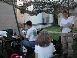
Michelle is also the head trainer for all ten installations, and delivers multiple-day training sessions on ESRI and Marine Corps standards. Other occasional functions include going out in the field with a Global Positioning Systems (GPS) Analyst to gather geographical data such as range signs used by the police officers in rural areas. During last years San Diego fires, she and her colleagues worked 12-hour shifts tracking burn locations, hot spots, and evacuation sites to support the Emergency Operations Center.
While in the office, Michelle works at a computer for much of the day, and may also attend meetings, take phone calls, and multi-task. She reports that her company is pretty laid back and easy going. The dress code at Camp Pendleton is business casual; Michelle wears dress slacks with heels and a button-down shirt. When offsite or at meetings with installation staff, commanding officers, or higher, she typically wears a suit.
Career Ladder: Michelle has found that GIS offers many more opportunities than she expected. Some GIS professionals go into analysis, software programming, or systems or database administration, others teach. Although some people choose to remain technical, Michelle finds herself moving in another direction. I never thought of myself as becoming a larger project manager, or a program manager, or a GIS manager for a city, but thats where my career is heading now. She finds that she uses her technical knowledge less as she calls upon her project management skills. Michelle recommends that women new to the field get grounded doing data manipulation, cartography, and improve their technical skills for a few years before branching into a specialized area. Management and consulting positions also offer career advancement potential.
Michelle has found that salaries in a municipality start from about $36K and advance for management roles to about $80K+. With several years of experience, consulting positions like Michelles may offer up to $80K to over $100K. She recommends the URISA salary survey at www.urisa.org to women who would like more information. Benefit packages cover the basics of health, dental, vision, life insurance, and 401K and/or retirement account.
Professional Associations: Michelle belongs to the Urban and Regional Information Systems Association (URISA) and the GIS Corps, which is kind of like a Peace Corps for GIS professionals.
Hobbies: I work all the time, says Michelle, when asked about hobbies. She does enjoy the outdoors and occasionally fits in a round of golf, sometimes with her father, a businessman who has encouraged her career. She also enjoys reading novels.
 Copyright 2010 National Institute for Women in Trades, Technology & Science | http://www.iwitts.com |